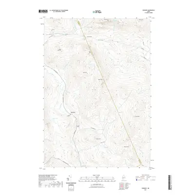
2021 Map of Roxbury
USGS Topo · Published 2021About this map
Roxbury serves as the primary hub of this mountainous region where the Swift River and East Branch Swift River meet. The terrain is defined by a dense network of peaks and ridges, including Tumbledown Mtn, Spruce Mtn, and Whale Back Mtn. Human activity is concentrated along the river valleys, as seen with the positioning of the Thomas Airport and a string of burial grounds such as the Roxbury Village Cem and Shaw Cem. The map illustrates a landscape of high-elevation water bodies like Tumbledown Pond and Birch Pond, which drain through numerous brooks including Noisy Brook and Walker Brook. These waterways and gaps, such as Byron Notch, have historically dictated the placement of local thoroughfares like Weld RD and Roxbury RD, linking the isolated valleys between the Franklin Co and Oxford Co border.
Find a feature on this map
48 named features on this map. Tap any name to fly to it.
Don’t see what you’re looking for? This feature index may not catch every label — zoom into the map to look around manually.
Map Details
Editions of this 2021 Roxbury Map
This is the sole edition of this map. No revisions or reprints were ever made.
Other maps of this area

1926 · Dixfield
USGS Topo · 1:62,500

1927 · Rumford
USGS Topo · 1:48,000

1929 · Phillips
USGS Topo · 1:48,000

1929 · Dixfield
USGS Topo · 1:62,500

1930 · Rumford
USGS Topo · 1:62,500

1932 · Phillips
USGS Topo · 1:62,500

1933 · Rangeley
USGS Topo · 1:48,000

1939 · Rangeley
USGS Topo · 1:62,500

1949 · Rangeley
USGS Topo · 1:62,500

1950 · Lewiston
USGS Topo · 1:250,000