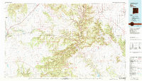
1981 Map of Roy
USGS Topo · Published 1982About this map
Fort Union Nat Mon sits at the edge of the Turkey Mountains in this early 1980s view of northeastern New Mexico, where the historic Santa Fe Trail cuts across a landscape of mesas and deep canyons. The high plains are marked by significant volcanic features like Maxson Crater and the broad reaches of Mesas del Conjelon. The Atchison Topeka and Santa Fe railroad corridor serves the cattle-ranching hubs of Roy and Solano, while smaller outposts like Valmora and Watrous follow the course of the Mora River.
Find a feature on this map
91 named features on this map. Tap any name to fly to it.
Don’t see what you’re looking for? This feature index may not catch every label — zoom into the map to look around manually.
Map Details
Editions of this 1981 Roy Map
This is the sole edition of this map. No revisions or reprints were ever made.
Other maps of this area

1889 · Las Vegas
USGS Topo · 1:125,000

1890 · Bernal
USGS Topo · 1:125,000

1891 · Bernal
USGS Topo · 1:125,000

1891 · Las Vegas
USGS Topo · 1:125,000

1892 · Watrous
USGS Topo · 1:125,000

1892 · Corazon
USGS Topo · 1:125,000

1893 · Las Vegas
USGS Topo · 1:125,000

1894 · Corazon
USGS Topo · 1:125,000

1894 · Watrous
USGS Topo · 1:125,000

1894 · Bernal
USGS Topo · 1:125,000