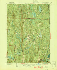
1946 Map of Royalston
USGS Topo · Published 1946About this map
Royalston and its outlying villages sit within a landscape of prominent highlands and narrow stream valleys just after the Second World War. The area is defined by the steep relief of Tully Mtn and Packard Heights, with the local economy and settlement pattern closely tied to the water power of the Millers River and its tributaries. In the southern portion of the map, the Boston and Maine railroad tracks follow the river's path, serving the industrial hamlet of South Royalston. Northward, the village of Fryeville and the small waters of Little Pond and Long Pond illustrate a dispersed rural network connected by old roads like Stockwell Road and Butterworth Road. The map also captures the interstate boundary where Massachusetts meets New Hampshire, showing the proximity of Laurel Lake and Sportsman Pond to the northern border of the township.
Find a feature on this map
46 named features on this map. Tap any name to fly to it.
Don’t see what you’re looking for? This feature index may not catch every label — zoom into the map to look around manually.
Map Details
Editions of this 1946 Royalston Map
2 editions found
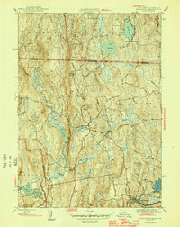
Other maps of this area

1887 · Warwick
USGS Topo · 1:62,500

1887 · Winchendon
USGS Topo · 1:62,500

1889 · Warwick
USGS Topo · 1:62,500

1890 · Winchendon
USGS Topo · 1:62,500

1894 · Winchendon
USGS Topo · 1:62,500

1894 · Warwick
USGS Topo · 1:62,500

1898 · Monadnock
USGS Topo · 1:62,500

1898 · Keene
USGS Topo · 1:62,500

1932 · Warwick
USGS Topo · 1:48,000

1932 · Winchendon
USGS Topo · 1:48,000