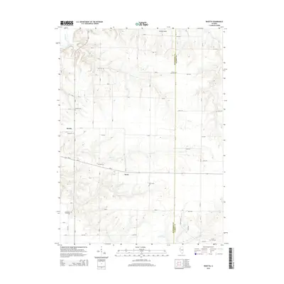
2015 Map of Rozetta
USGS Topo · Published 2015About this map
The agrarian landscape of Henderson Co and Warren Co is defined by a dense network of family and community burial sites, many of which remain as quiet landmarks in the Illinois countryside. The settlement of Rozetta sits near several such grounds, including Stockton Cem and Rozetta Cem. To the south, the small community of Reeds is positioned near Smith Creek Cem and Carner Lake. The terrain is deeply etched by a system of waterways like Henderson Creek and Fall Cr, which break up the grid of section roads and rural lanes. Genealogists will find this 2015 survey invaluable for its meticulous detail regarding these local cemeteries, such as the Cumberland Presbyterian Cem and Coghill Cem, which provide a clear spatial record of the region's heritage and the early congregations that once shaped the area's social fabric.
Find a feature on this map
58 named features on this map. Tap any name to fly to it.
Don’t see what you’re looking for? This feature index may not catch every label — zoom into the map to look around manually.
Map Details
Editions of this 2015 Rozetta Map
This is the sole edition of this map. No revisions or reprints were ever made.
Other maps of this area

1921 · Monmouth
USGS Topo · 1:62,500

1923 · Monmouth
USGS Topo · 1:62,500

1923 · Alexis
USGS Topo · 1:62,500

1925 · Alexis
USGS Topo · 1:62,500

1934 · Oquawka
USGS Topo · 1:48,000

1935 · Keithsburg
USGS Topo · 1:48,000

1940 · Oquawka
USGS Topo · 1:62,500

1941 · Keithsburg
USGS Topo · 1:62,500

1958 · Burlington
USGS Topo · 1:250,000

1958 · Davenport
USGS Topo · 1:250,000