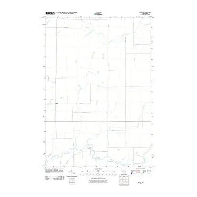
2010 Map of Ruby
USGS Topo · Published 2010About this map
The settlement of Ruby sits at the intersection of County Hwy-G and County Hwy-Hwy W in a landscape defined by its riparian network. The northern portion of the region is drained by the Fisher River, while the Yellow River winds across the southern reaches. This modern topographic study shows a rural area organized by a strict grid of county highways and named local roads such as Buswell Rd and S Loop Rd. Local history is anchored by the Yellow River Cemetery, located near a prominent bend in the river. Numerous small tributaries, including Elder Creek, Christmas Creek, and Hay Creek, carve through the terrain, illustrating the intricate drainage patterns that have shaped land use and local property boundaries in Chippewa County.
Find a feature on this map
34 named features on this map. Tap any name to fly to it.
Don’t see what you’re looking for? This feature index may not catch every label — zoom into the map to look around manually.
Map Details
Editions of this 2010 Ruby Map
This is the sole edition of this map. No revisions or reprints were ever made.
Other maps of this area

1947 · Sheldon
USGS Topo · 1:48,000

1948 · Ladysmith
USGS Topo · 1:48,000

1949 · Sheldon
USGS Topo · 1:48,000

1950 · Ladysmith
USGS Topo · 1:48,000

1951 · Cornell
USGS Topo · 1:62,500

1951 · Gilman
USGS Topo · 1:62,500

1953 · Rice Lake
USGS Topo · 1:250,000

1959 · Rice Lake
USGS Topo · 1:250,000
1971 · Jump River
USGS Topo · 1:24,000
1971 · Ladysmith SE
USGS Topo · 1:24,000