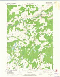
1971 Map of Jump River
USGS Topo · Published 1974About this map
Jump River and the small settlement of Hannibal anchor this 1970s survey of Taylor County. The landscape is defined by its water management and conservation history, featuring the expansive Pershing State Wildlife Management Area and several large impoundments such as Monson Flowage, Waterfowl Flowage, and Holzer Flowage. These water bodies, situated within the townships of McKinley, Pershing, and Cleveland, reflect the region's transition from early industrial use toward managed natural spaces.
Find a feature on this map
20 named features on this map. Tap any name to fly to it.
Don’t see what you’re looking for? This feature index may not catch every label — zoom into the map to look around manually.
Map Details
Editions of this 1971 Jump River Map
This is the sole edition of this map. No revisions or reprints were ever made.
Other maps of this area

1945 · Black River
USGS Topo · 1:48,000

1947 · Sheldon
USGS Topo · 1:48,000

1949 · Sheldon
USGS Topo · 1:48,000

1949 · Jump River Fire Tower
USGS Topo · 1:48,000

1951 · Lublin
USGS Topo · 1:48,000

1951 · Gilman
USGS Topo · 1:62,500

1953 · Rice Lake
USGS Topo · 1:250,000

1959 · Rice Lake
USGS Topo · 1:250,000
1969 · Lublin NW
USGS Topo · 1:24,000
1970 · Jump River Fire Tower NW
USGS Topo · 1:24,000