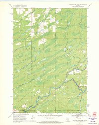
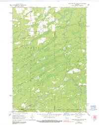
1970 Map of Jump River Fire Tower NW
USGS Topo · Published 1972About this map
Big Falls and its surrounding rapids dominate the landscape where the North Fork Jump River and South Fork Jump River converge. This 1970 field-checked survey reveals a heavily forested and water-rich environment spanning the boundaries of Rusk, Taylor, and Price counties. The presence of an Old Railroad Grade snaking through the townships of Hawkins and Kennan points to a history of timber extraction or early transit that once defined these Northwoods.
Find a feature on this map
26 named features on this map. Tap any name to fly to it.
Don’t see what you’re looking for? This feature index may not catch every label — zoom into the map to look around manually.
Map Details
Editions of this 1970 Jump River Fire Tower NW Map
3 editions found
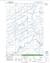
Other maps of this area

1941 · Kennan
USGS Topo · 1:48,000

1945 · Kennan
USGS Topo · 1:48,000

1945 · Black River
USGS Topo · 1:48,000

1945 · Ingram
USGS Topo · 1:48,000

1947 · Ingram
USGS Topo · 1:48,000

1947 · Sheldon
USGS Topo · 1:48,000

1949 · Sheldon
USGS Topo · 1:48,000

1949 · Jump River Fire Tower
USGS Topo · 1:48,000

1953 · Rice Lake
USGS Topo · 1:250,000

1959 · Rice Lake
USGS Topo · 1:250,000