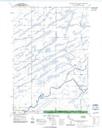
1970 Map of Jump River Fire Tower NW
USGS Topo · Published 1992About this map
The Jump River and its complex network of tributaries define this wooded landscape on the borders of Rusk, Price, and Taylor counties. In the southern portion of the sheet, the Chequamegon National Forest and its Medford Ranger District encompass a region dominated by wetlands and watercourses. The river itself creates a notable landmark at Big Falls, where the Big Falls Campground is situated along the South Fork near the terminus of Big Falls Road. This area illustrates the transition from the township-and-range agricultural grid to more dense, protected forest land during the early 1970s. The northern reaches are drained by the South Fork Main Creek and the Little Jump River, with numerous small gravel pits and rural routes like Morgan Creek Road and Green Creek Rd providing access to the interior. Small creeks such as Alder Creek, Gilbert Creek, and Wolf Creek form a dense drainage pattern across the townships of Hawkins, Kennan, and Westboro.
Find a feature on this map
28 named features on this map. Tap any name to fly to it.
Don’t see what you’re looking for? This feature index may not catch every label — zoom into the map to look around manually.
Map Details
Editions of this 1970 Jump River Fire Tower NW Map
3 editions found
Other maps of this area

1941 · Kennan
USGS Topo · 1:48,000

1945 · Kennan
USGS Topo · 1:48,000

1945 · Black River
USGS Topo · 1:48,000

1945 · Ingram
USGS Topo · 1:48,000

1947 · Ingram
USGS Topo · 1:48,000

1947 · Sheldon
USGS Topo · 1:48,000

1949 · Sheldon
USGS Topo · 1:48,000

1949 · Jump River Fire Tower
USGS Topo · 1:48,000

1953 · Rice Lake
USGS Topo · 1:250,000

1959 · Rice Lake
USGS Topo · 1:250,000