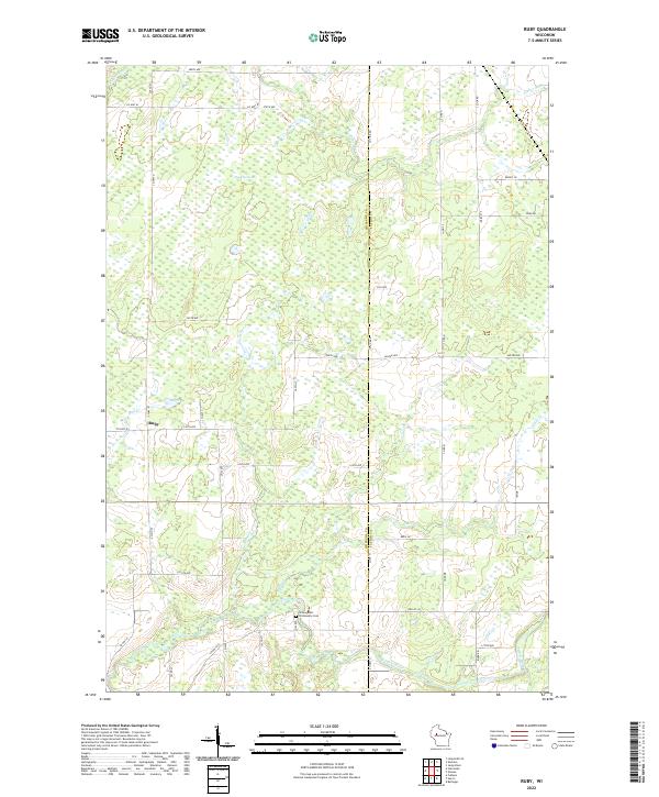
2022 Map of Ruby
USGS Topo · Published 2022About this map
Ruby sits at the western edge of this landscape, positioned where Co Hwy G and Co Hwy W intersect amidst a complex drainage network. The terrain is defined by the expansive Ruby Swamps and a series of watercourses including Christmas Cr, Hay Cr, and Elder Cr that feed into the southern reaches of the Yellow River. This region on the border of Chippewa and Taylor counties reflects a rural pattern of development tied to the wetland topography, with roads often following section lines around the saturated ground.
Find a feature on this map
43 named features on this map. Tap any name to fly to it.
Don’t see what you’re looking for? This feature index may not catch every label — zoom into the map to look around manually.
Map Details
Editions of this 2022 Ruby Map
This is the sole edition of this map. No revisions or reprints were ever made.
Other maps of this area

1947 · Sheldon
USGS Topo · 1:48,000

1948 · Ladysmith
USGS Topo · 1:48,000

1949 · Sheldon
USGS Topo · 1:48,000

1950 · Ladysmith
USGS Topo · 1:48,000

1951 · Cornell
USGS Topo · 1:62,500

1951 · Gilman
USGS Topo · 1:62,500

1953 · Rice Lake
USGS Topo · 1:250,000

1959 · Rice Lake
USGS Topo · 1:250,000
1971 · Jump River
USGS Topo · 1:24,000
1971 · Ladysmith SE
USGS Topo · 1:24,000