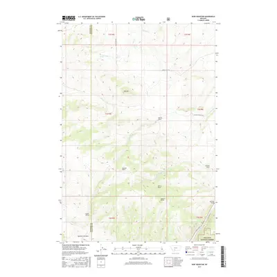
2017 Map of Ruby Mountain
USGS Topo · Published 2017About this map
Ruby Mtn stands at the center of this high-elevation landscape, where the Madison and Gallatin county lines meet. The terrain is defined by a complex drainage system feeding into the Gallatin River at the southeastern corner of the survey. Significant relief is evident through several prominent canyons, including Merritt Gulch, Maryott Gulch, and Browns Gulch, which cut through the mountain slopes.
Find a feature on this map
28 named features on this map. Tap any name to fly to it.
Don’t see what you’re looking for? This feature index may not catch every label — zoom into the map to look around manually.
Map Details
Editions of this 2017 Ruby Mountain Map
This is the sole edition of this map. No revisions or reprints were ever made.
Other maps of this area

1888 · Three Forks
USGS Topo · 1:250,000

1894 · Three Forks
USGS Topo · 1:250,000

1895 · Three Forks
USGS Topo · 1:250,000

1947 · Bozeman
USGS Topo · 1:250,000

1948 · Bozeman
USGS Topo · 1:250,000

1949 · Anceney
USGS Topo · 1:62,500

1950 · Spanish Peaks
USGS Topo · 1:62,500

1953 · Bozeman
USGS Topo · 1:62,500

1955 · Bozeman
USGS Topo · 1:250,000

1955 · Garnet Mountain
USGS Topo · 1:62,500