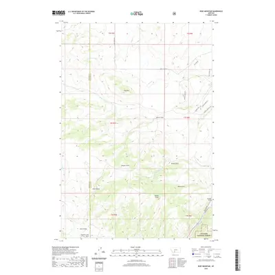
2020 Map of Ruby Mountain
USGS Topo · Published 2020About this map
Ruby Mtn stands as the central topographic anchor in this portion of the Gallatin National Forest, where the Madison and Gallatin county lines meet. The landscape is defined by a complex network of drainage systems, including Elk Cr and Camp Cr, which carve through deep ravines such as Merritt Gulch and Maryott Gulch. This modern survey illustrates the persistent ranching and wilderness character of the region, evidenced by historic water infrastructure like the Williams Ditch and the crossing at Harringer Bridge over the Gallatin River. Trail systems like the Stampede Trl and Mountain Man Trl trace the high ridges and breaks. The southern reaches are dominated by the Spanish Creek Basin and the striking Spanish Breaks, revealing a terrain that has remained largely defined by its natural contours and limited rural access roads.
Find a feature on this map
33 named features on this map. Tap any name to fly to it.
Don’t see what you’re looking for? This feature index may not catch every label — zoom into the map to look around manually.
Map Details
Editions of this 2020 Ruby Mountain Map
This is the sole edition of this map. No revisions or reprints were ever made.
Other maps of this area

1888 · Three Forks
USGS Topo · 1:250,000

1894 · Three Forks
USGS Topo · 1:250,000

1895 · Three Forks
USGS Topo · 1:250,000

1947 · Bozeman
USGS Topo · 1:250,000

1948 · Bozeman
USGS Topo · 1:250,000

1949 · Anceney
USGS Topo · 1:62,500

1950 · Spanish Peaks
USGS Topo · 1:62,500

1953 · Bozeman
USGS Topo · 1:62,500

1955 · Bozeman
USGS Topo · 1:250,000

1955 · Garnet Mountain
USGS Topo · 1:62,500