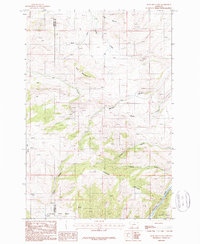
1987 Map of Ruby Mountain
USGS Topo · Published 1988About this map
Ruby Mountain towers over a landscape defined by deep drainages and early mining ventures along the Madison and Gallatin county line. In the late 20th century, this area remained largely primitive, with significant portions protected within the Gallatin National Forest. The map records evidence of mineral exploration, specifically a Mine Shaft and the Prospects Mine located north of Maryott Creek. These sites, along with various unlabeled prospects, suggest a history of prospecting in the high elevations between Elk Creek and Goose Gulch.
Find a feature on this map
19 named features on this map. Tap any name to fly to it.
Don’t see what you’re looking for? This feature index may not catch every label — zoom into the map to look around manually.
Map Details
Editions of this 1987 Ruby Mountain Map
This is the sole edition of this map. No revisions or reprints were ever made.
Other maps of this area

1888 · Three Forks
USGS Topo · 1:250,000

1894 · Three Forks
USGS Topo · 1:250,000

1895 · Three Forks
USGS Topo · 1:250,000

1947 · Bozeman
USGS Topo · 1:250,000

1948 · Bozeman
USGS Topo · 1:250,000

1949 · Anceney
USGS Topo · 1:62,500

1950 · Spanish Peaks
USGS Topo · 1:62,500

1953 · Bozeman
USGS Topo · 1:62,500

1955 · Bozeman
USGS Topo · 1:250,000

1955 · Garnet Mountain
USGS Topo · 1:62,500