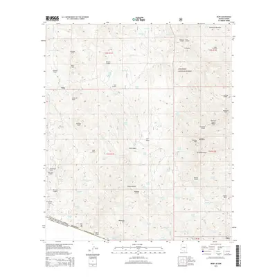
2014 Map of Ruby
USGS Topo · Published 2014About this map
The settlement of Ruby sits at the base of Ruby Peak and Chiminea Peak in a remote stretch of southern Arizona along the international border. This high-desert terrain is characterized by a dense network of water features critical for survival, including Ruby Lakes, Footes Spring, and numerous tanks like Broken Tank and Salty Tank. The landscape is dominated by the Coronado National Forest, encompassing the Tumacacori Mountains and the Atascosa Mountains. Notable geological landmarks such as the Ramanote Canyon Natural Arch and Hells Gate punctuate the drainage systems of Sycamore Canyon and Ramanote Canyon. The border with the United States of America Estados Unidos Mexicanos defines the southern extent of the map, where canyons like Old Glory Canyon and Warsaw Canyon cut through the rugged slopes of the Pajarito Mountains. This survey provides a precise look at the canyons and gulches that once supported mining and ranching interests in this borderland.
Find a feature on this map
86 named features on this map. Tap any name to fly to it.
Don’t see what you’re looking for? This feature index may not catch every label — zoom into the map to look around manually.
Map Details
Editions of this 2014 Ruby Map
This is the sole edition of this map. No revisions or reprints were ever made.
Other maps of this area

1920 · Arivaca
USGS Topo · 1:125,000

1921 · Old Glory
USGS Topo · 1:125,000

1939 · Tubac
USGS Topo · 1:62,500

1941 · Arivaca
USGS Topo · 1:62,500

1942 · Ruby
USGS Topo · 1:62,500

1942 · Oro Blanco
USGS Topo · 1:62,500

1943 · Arivaca
USGS Topo · 1:62,500

1943 · Old Glory
USGS Topo · 1:125,000

1943 · Tubac
USGS Topo · 1:62,500

1944 · Oro Blanco
USGS Topo · 1:62,500