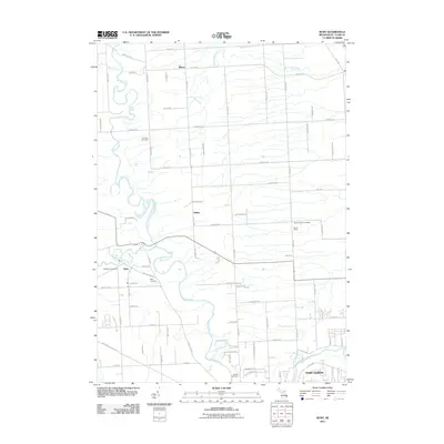
2011 Map of Ruby
USGS Topo · Published 2011About this map
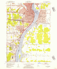
The Black River meanders through this landscape in St. Clair County, carving a path between the small settlements of Atkins, Ruby, and Blaine. This early 21st-century survey documents the transition of Clyde Township as it meets the outskirts of Port Huron. The map provides significant detail for local historians and genealogists, pinpointing the location of the North Street Post Office and several burial grounds, including Harmony Cemetery and Westbrook Cemetery. The road network is dense with named thoroughfares such as Metcalf Rd and Norman Rd, while smaller tributaries like Doe Creek and Mill Creek feed into the river system. The presence of the Morris Drain indicates a carefully managed agricultural and drainage landscape, typical of the region's development before further suburban expansion.
Find a feature on this map
78 named features on this map. Tap any name to fly to it.
Don’t see what you’re looking for? This feature index may not catch every label — zoom into the map to look around manually.
Map Details
Editions of this 2011 Ruby Map
This is the sole edition of this map. No revisions or reprints were ever made.
Other maps of this area

1912 · Port Huron
USGS Topo · 1:62,500

1928 · Hicky
USGS Topo · 1:62,500

1929 · Port Huron
USGS Topo · 1:62,500

1939 · Port Huron
USGS Topo · 1:24,000

1939 · Smiths Creek
USGS Topo · 1:24,000

1939 · Goodells
USGS Topo · 1:24,000
1949 · Port Huron
USGS Topo · 1:24,000
1952 · Smiths Creek
USGS Topo · 1:24,000
1952 · Goodells
USGS Topo · 1:24,000
1952 · Port Huron
USGS Topo · 1:24,000
Featured Places
- Atkins, MI
- Grant Township, MI
- Clyde Township, MI
- Burtchville Township, MI
- Port Huron Charter Township, MI