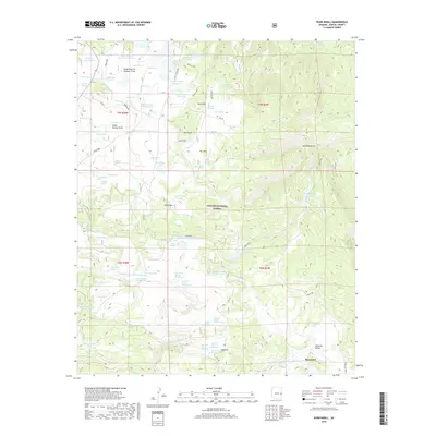
2018 Map of Rudd Knoll
USGS Topo · Published 2018About this map
Apache National Forest lands dominate this high-elevation landscape, where a sophisticated network of water management features supports the high-country terrain. Natural features like Saint Marys Lake and Jessie Spring Marsh are complemented by man-made catchments including Russell Reservoir, Saint Josephs Reservoir, and San Salvador Reservoir. The geography is defined by prominent elevations such as Rudd Knoll and Pat Knoll, separated by the lower reaches of Williams Valley and the basin at Boneyard. Resource extraction is evident through numerous specialized excavations, including the Rudd Knoll Pit series and several Udall Pit locations. The map detail highlights an extensive network of forest access routes like Water Canyon Rd and the Saffel OHV trail, alongside numerous livestock tanks and springs that underscore the area's utility for seasonal grazing and watershed protection.
Find a feature on this map
96 named features on this map. Tap any name to fly to it.
Don’t see what you’re looking for? This feature index may not catch every label — zoom into the map to look around manually.
Map Details
Editions of this 2018 Rudd Knoll Map
This is the sole edition of this map. No revisions or reprints were ever made.
Other maps of this area

1886 · St Johns
USGS Topo · 1:250,000

1892 · St Johns
USGS Topo · 1:250,000

1922 · Nutrioso
USGS Topo · 1:125,000

1954 · Clifton
USGS Topo · 1:250,000

1954 · Saint Johns
USGS Topo · 1:250,000

1957 · Clifton
USGS Topo · 1:250,000

1957 · Saint Johns
USGS Topo · 1:250,000

1958 · Clifton
USGS Topo · 1:250,000

1958 · Saint Johns
USGS Topo · 1:250,000

1958 · Alpine
USGS Topo · 1:62,500