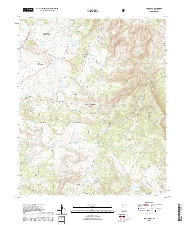
2021 Map of Rudd Knoll
USGS Topo · Published 2021About this map
Apache National Forest lands dominate this high-altitude landscape in eastern Arizona, characterized by an extensive network of water management features and seasonal draws. The terrain is marked by numerous reservoirs and tanks, such as Saint Josephs Reservoir, San Salvador Reservoir, and the Rudd Reservoir, which reflect the region's managed water resources for ranching and forest maintenance. A sophisticated system of forest roads and trails, including the White Mountain Scenic Road, Overland Trl, and Saffel Ohv Trl, provides access through the diverse topography of O D Ridge and Chambers Draw. Industrial activity is localized at the Udall Pit and Udall Pit Number Five, while landmarks like Pat Knoll and Saint Marys Lake serve as primary orientation points. The map details a complex hydrology of springs and tanks, from Lost Spring to the Salt House Tank, essential for navigation and resource management in this portion of Apache County.
Find a feature on this map
77 named features on this map. Tap any name to fly to it.
Don’t see what you’re looking for? This feature index may not catch every label — zoom into the map to look around manually.
Map Details
Editions of this 2021 Rudd Knoll Map
This is the sole edition of this map. No revisions or reprints were ever made.
Other maps of this area

1886 · St Johns
USGS Topo · 1:250,000

1892 · St Johns
USGS Topo · 1:250,000

1922 · Nutrioso
USGS Topo · 1:125,000

1954 · Clifton
USGS Topo · 1:250,000

1954 · Saint Johns
USGS Topo · 1:250,000

1957 · Clifton
USGS Topo · 1:250,000

1957 · Saint Johns
USGS Topo · 1:250,000

1958 · Clifton
USGS Topo · 1:250,000

1958 · Saint Johns
USGS Topo · 1:250,000

1958 · Alpine
USGS Topo · 1:62,500