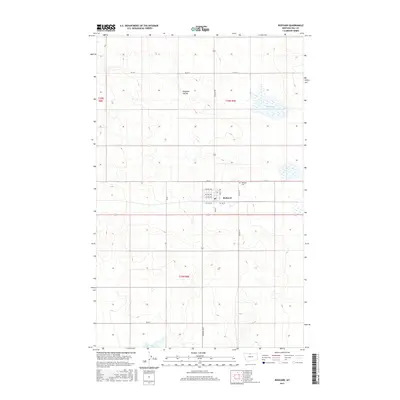
2017 Map of Rudyard
USGS Topo · Published 2017About this map
Rudyard occupies the heart of this High Line landscape, positioned along the vital corridor of the Burlington Northern Santa Fe railroad. The town's grid is clearly defined by residential streets such as Main St and Lincoln St, while the surrounding prairie is marked by the intermittent drainage of Hingham Coulee and the basin of Hingham Lake to the northeast. This 2017 survey shows the agrarian layout of Hill County, where section lines and local roads like Rudyard Rd and Co Rd 6 N facilitate the movement of grain and goods across the northern plains. The presence of the Rudyard Cem on the northern edge of the community provides a specific point of interest for those tracing local family histories in this part of Montana.
Find a feature on this map
24 named features on this map. Tap any name to fly to it.
Don’t see what you’re looking for? This feature index may not catch every label — zoom into the map to look around manually.
Map Details
Editions of this 2017 Rudyard Map
This is the sole edition of this map. No revisions or reprints were ever made.
Other maps of this area

1919 · Big Sandy
USGS Topo · 1:125,000

1919 · Alma
USGS Topo · 1:125,000

1920 · Gildford
USGS Topo · 1:125,000

1943 · Gildford
USGS Topo · 1:125,000

1954 · Shelby
USGS Topo · 1:250,000

1958 · Shelby
USGS Topo · 1:250,000

1969 · Gildford NW
USGS Topo · 1:24,000

1969 · Hingham
USGS Topo · 1:24,000

1969 · Fourteenmile Coulee NW
USGS Topo · 1:24,000

1970 · Rocky Coulee
USGS Topo · 1:24,000