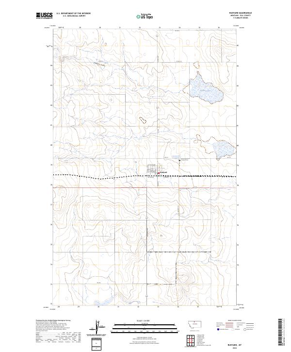
2024 Map of Rudyard
USGS Topo · Published 2024About this map
The small High Line community of Rudyard sits at the center of this Montana prairie landscape, organized around a tight grid of streets including Main St and Lincoln St. The town's layout reflects the methodical expansion of the Great Northern railway corridor, with the surrounding terrain defined by the sweeping depressions of Hingham Coulee and the intermittent waters of Hingham Lake to the northeast.
Find a feature on this map
25 named features on this map. Tap any name to fly to it.
Don’t see what you’re looking for? This feature index may not catch every label — zoom into the map to look around manually.
Map Details
Editions of this 2024 Rudyard Map
This is the sole edition of this map. No revisions or reprints were ever made.
Other maps of this area

1919 · Big Sandy
USGS Topo · 1:125,000

1919 · Alma
USGS Topo · 1:125,000

1920 · Gildford
USGS Topo · 1:125,000

1943 · Gildford
USGS Topo · 1:125,000

1954 · Shelby
USGS Topo · 1:250,000

1958 · Shelby
USGS Topo · 1:250,000

1969 · Gildford NW
USGS Topo · 1:24,000

1969 · Hingham
USGS Topo · 1:24,000

1969 · Fourteenmile Coulee NW
USGS Topo · 1:24,000

1970 · Rocky Coulee
USGS Topo · 1:24,000