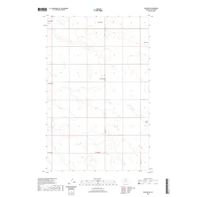
2020 Map of Rudyard NE
USGS Topo · Published 2020About this map
Hill County prairie stretches across this northern Montana landscape, defined by the drainage patterns of the High Line's characteristic coulees. The terrain is incised by the meandering path of Big Coulee in the northeast and O'Brien Coulee in the southeast, features that have dictated movement and land use in this part of the state for generations. A sparse but essential network of rural routes, including Rudyard Rd and Hwy 255, connects the sectional agricultural plots. The map reveals the precise layout of modern ranching and farming operations, where local thoroughfares like Co Rd 80 N and Power Line Rd follow the rigid grid of the Public Land Survey System. This survey documents a quiet corner of Montana where the high plains meet the intricate draws of the coulee systems.
Find a feature on this map
12 named features on this map. Tap any name to fly to it.
Don’t see what you’re looking for? This feature index may not catch every label — zoom into the map to look around manually.
Map Details
Editions of this 2020 Rudyard NE Map
This is the sole edition of this map. No revisions or reprints were ever made.
Other maps of this area

1919 · Alma
USGS Topo · 1:125,000

1920 · Gildford
USGS Topo · 1:125,000

1943 · Gildford
USGS Topo · 1:125,000

1954 · Shelby
USGS Topo · 1:250,000

1958 · Shelby
USGS Topo · 1:250,000

1969 · Gildford NW
USGS Topo · 1:24,000

1969 · Hingham
USGS Topo · 1:24,000
1972 · Rudyard
USGS Topo · 1:24,000

1972 · Goldstone SW
USGS Topo · 1:24,000

1972 · Rudyard NW
USGS Topo · 1:24,000