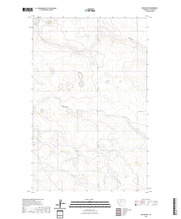
2024 Map of Rudyard NE
USGS Topo · Published 2024About this map
Big Coulee and O'Brien Coulee carve through the landscape of northern Montana in this 2024 survey of the Hill County area. The terrain is characterized by these significant drainage features, which dictate the placement of local infrastructure. A grid of rural routes provides access across the township lines, including the primary north-south artery of Hwy 255, which is supplemented by local connectors like Rudyard Rd and Co Rd 80 N. Utilities also cross the open country, represented by the path of Power Line Rd. This map reflects the modern configuration of Montana's agricultural and open-range country, where the intersection of water-carved coulees and the Public Land Survey System creates a distinct spatial pattern for land management and travel.
Find a feature on this map
12 named features on this map. Tap any name to fly to it.
Don’t see what you’re looking for? This feature index may not catch every label — zoom into the map to look around manually.
Map Details
Editions of this 2024 Rudyard NE Map
This is the sole edition of this map. No revisions or reprints were ever made.
Other maps of this area

1919 · Alma
USGS Topo · 1:125,000

1920 · Gildford
USGS Topo · 1:125,000

1943 · Gildford
USGS Topo · 1:125,000

1954 · Shelby
USGS Topo · 1:250,000

1958 · Shelby
USGS Topo · 1:250,000

1969 · Gildford NW
USGS Topo · 1:24,000

1969 · Hingham
USGS Topo · 1:24,000
1972 · Rudyard
USGS Topo · 1:24,000

1972 · Goldstone SW
USGS Topo · 1:24,000

1972 · Rudyard NW
USGS Topo · 1:24,000