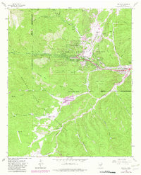
1963 Map of Ruidoso
USGS Topo · Published 1982About this map
The North Fork Rio Ruidoso and its tributaries converge near Ruidoso in this 1963 survey, revised in the late 1970s. The landscape is defined by the sharp boundary between the Lincoln National Forest and the Mescalero Apache Indian Reservation, which cuts through the southern half of the sheet. Urban development is concentrated along the river valley, where Hollywood and Ruidoso Downs transition from forest to the open spaces of Meadows and Paradise. Local landmarks like the Municipal Airport and the Drive-in Theater reflect the mid-century growth of this mountain community. Higher elevations are marked by distinctive landmarks such as Cow Mountain and Moon Mountain, while numerous water sources like Jose Second Dam No 1 and Snow Spring suggest the importance of water management in this arid terrain.
Find a feature on this map
54 named features on this map. Tap any name to fly to it.
Don’t see what you’re looking for? This feature index may not catch every label — zoom into the map to look around manually.
Map Details
Editions of this 1963 Ruidoso Map
3 editions found
Other maps of this area

1950 · Sierra Blanca Peak
USGS Topo · 1:62,500

1950 · Mescalero
USGS Topo · 1:62,500

1955 · Roswell
USGS Topo · 1:250,000

1958 · Roswell
USGS Topo · 1:250,000

1962 · Roswell
USGS Topo · 1:250,000

1963 · Fort Stanton
USGS Topo · 1:24,000

1963 · Ruidoso Downs
USGS Topo · 1:24,000

1963 · Ruidoso
USGS Topo · 1:24,000

1963 · Angus
USGS Topo · 1:24,000

1963 · Apache Summit
USGS Topo · 1:24,000