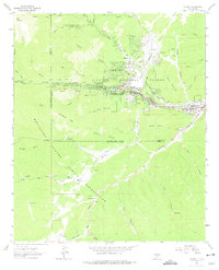
1963 Map of Ruidoso
USGS Topo · Published 1975About this map
Ruidoso serves as the focal point for this 1963 survey, where development is concentrated along the narrow valley floor created by the Rio Ruidoso. The village is hemmed in by the expansive terrain of the Lincoln National Forest to the north and the Mescalero Apache Indian Reservation to the south. This placement illustrates the early growth of the community within restricted federal and tribal boundaries, with residential pockets like Ponderosa Heights beginning to climb the canyon walls.
Find a feature on this map
68 named features on this map. Tap any name to fly to it.
Don’t see what you’re looking for? This feature index may not catch every label — zoom into the map to look around manually.
Map Details
Editions of this 1963 Ruidoso Map
3 editions found
Other maps of this area

1950 · Sierra Blanca Peak
USGS Topo · 1:62,500

1950 · Mescalero
USGS Topo · 1:62,500

1955 · Roswell
USGS Topo · 1:250,000

1958 · Roswell
USGS Topo · 1:250,000

1962 · Roswell
USGS Topo · 1:250,000

1963 · Fort Stanton
USGS Topo · 1:24,000

1963 · Ruidoso Downs
USGS Topo · 1:24,000

1963 · Ruidoso
USGS Topo · 1:24,000

1963 · Angus
USGS Topo · 1:24,000

1963 · Apache Summit
USGS Topo · 1:24,000