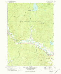
1973 Map of Rumney
USGS Topo · Published 1975About this map
White Mountain National Forest territory dominates this 1970s landscape, where the Baker River carves a winding valley through the peaks of Rumney. The settlement pattern follows the river's path, connecting West Rumney and Rumney Depot along a route marked by older transportation infrastructure, including a prominent Railroad Grade. Local life is anchored by landmarks like the Russell Sch and the geological curiosity of Polar Caves, while higher elevations feature rugged landmarks such as Stinson Mtn and its Lookout Tower. To the north, Stinson Lake serves as a remote hub, while the southern reaches near Groton show the industrial footprint of a Quarry and Gravel Pits. This survey captures the transition between organized valley townships and the high, protected wilderness of the New Hampshire interior.
Find a feature on this map
45 named features on this map. Tap any name to fly to it.
Don’t see what you’re looking for? This feature index may not catch every label — zoom into the map to look around manually.
Map Details
Editions of this 1973 Rumney Map
This is the sole edition of this map. No revisions or reprints were ever made.
Other maps of this area

1925 · Holderness
USGS Topo · 1:62,500

1927 · Holderness
USGS Topo · 1:62,500

1927 · Cardigan
USGS Topo · 1:62,500

1928 · Plymouth
USGS Topo · 1:62,500

1928 · Rumney
USGS Topo · 1:62,500

1930 · Cardigan
USGS Topo · 1:62,500

1931 · Plymouth
USGS Topo · 1:62,500

1932 · Rumney
USGS Topo · 1:62,500

1949 · Portland
USGS Topo · 1:250,000

1956 · Cardigan
USGS Topo · 1:62,500