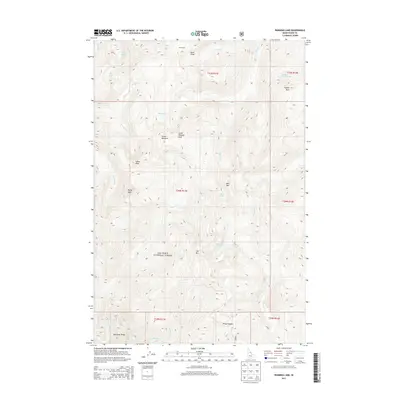
2013 Map of Running Lake
USGS Topo · Published 2013About this map
Nez Perce National Forest encompasses the entirety of this Idaho mountain terrain, where a complex network of high peaks and alpine basins defines the landscape. Drainage patterns are dominated by Running Cr, which flows south through the center of the sheet, and Marten Cr to its east. High-elevation points like Grave Meadow Peak, Indian Peak, and Bilk Mtn separate the various drainages, creating isolated basins that hold small water bodies such as Bilk Lake, Red Lake, and the map's namesake Running Lake. The area's topography is marked by significant geologic features including the Rock Pillar and Matteson Ridge. This remote section of the forest is characterized by several meadows and saddles, such as Grave Meadow and Windy Saddle, which provide breaks in the ridgelines and have served as historical points of reference for navigation through the northern Rockies.
Find a feature on this map
39 named features on this map. Tap any name to fly to it.
Don’t see what you’re looking for? This feature index may not catch every label — zoom into the map to look around manually.
Map Details
Editions of this 2013 Running Lake Map
This is the sole edition of this map. No revisions or reprints were ever made.
Other maps of this area

1911 · Lolo
USGS Topo · 1:250,000

1913 · Lolo
USGS Topo · 1:250,000

1956 · Elk City
USGS Topo · 1:250,000

1956 · Hamilton
USGS Topo · 1:250,000

1959 · Hamilton
USGS Topo · 1:250,000

1960 · Elk City
USGS Topo · 1:250,000

1960 · Hamilton
USGS Topo · 1:250,000

1964 · Hamilton
USGS Topo · 1:250,000

1966 · Moose Ridge
USGS Topo · 1:24,000

1966 · Green Mtn.
USGS Topo · 1:24,000