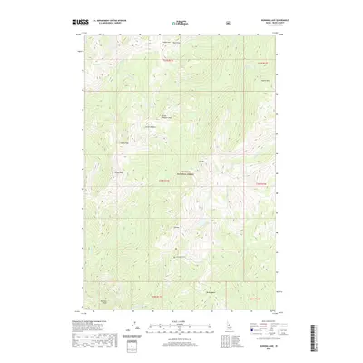
2020 Map of Running Lake
USGS Topo · Published 2020About this map
Nez Perce National Forest encompasses this high mountain landscape in Idaho County, characterized by a network of glacial lakes and steep ridges. The drainage patterns are defined by Running Cr and Meadow Cr, which cut through the complex topography of Matteson Ridge and Bilk Mtn. High-altitude water bodies such as Running Lake, Bilk Lake, and the remote Square Rock Lake are scattered throughout the northern and central portions of the quadrangle. Human infrastructure is minimal, centered largely on Elk Mountain Rd and the prominent Windy Saddle. Historically significant landmarks like Grave Meadow and Grave Meadow Peak suggest early forest use, while named features such as Rock Pillar and Square Rock highlight the distinctive geological outcrops that define this stretch of the Idaho wilderness.
Find a feature on this map
40 named features on this map. Tap any name to fly to it.
Don’t see what you’re looking for? This feature index may not catch every label — zoom into the map to look around manually.
Map Details
Editions of this 2020 Running Lake Map
This is the sole edition of this map. No revisions or reprints were ever made.
Other maps of this area

1911 · Lolo
USGS Topo · 1:250,000

1913 · Lolo
USGS Topo · 1:250,000

1956 · Elk City
USGS Topo · 1:250,000

1956 · Hamilton
USGS Topo · 1:250,000

1959 · Hamilton
USGS Topo · 1:250,000

1960 · Elk City
USGS Topo · 1:250,000

1960 · Hamilton
USGS Topo · 1:250,000

1964 · Hamilton
USGS Topo · 1:250,000

1966 · Moose Ridge
USGS Topo · 1:24,000

1966 · Green Mtn.
USGS Topo · 1:24,000