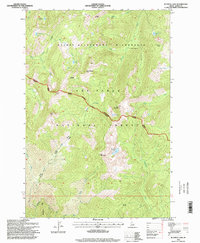
1995 Map of Running Lake
USGS Topo · Published 1999About this map
The First Smoke Jump Site marks a pivotal location in wildland firefighting history within the northern reaches of the Selway Bitterroot Wilderness. This terrain is characterized by high alpine peaks and drainage systems where the Nez Perce National Forest meets the Wilderness Boundary. Significant summits like Grave Meadow Peak, Elk Mountain, and Bilk Mountain define the watershed, feeding a network of alpine lakes including Running Lake, Bilk Lake, and Red Lake.
Find a feature on this map
40 named features on this map. Tap any name to fly to it.
Don’t see what you’re looking for? This feature index may not catch every label — zoom into the map to look around manually.
Map Details
Editions of this 1995 Running Lake Map
This is the sole edition of this map. No revisions or reprints were ever made.
Other maps of this area

1911 · Lolo
USGS Topo · 1:250,000

1913 · Lolo
USGS Topo · 1:250,000

1956 · Elk City
USGS Topo · 1:250,000

1956 · Hamilton
USGS Topo · 1:250,000

1959 · Hamilton
USGS Topo · 1:250,000

1960 · Elk City
USGS Topo · 1:250,000

1960 · Hamilton
USGS Topo · 1:250,000

1964 · Hamilton
USGS Topo · 1:250,000

1966 · Moose Ridge
USGS Topo · 1:24,000

1966 · Green Mtn.
USGS Topo · 1:24,000