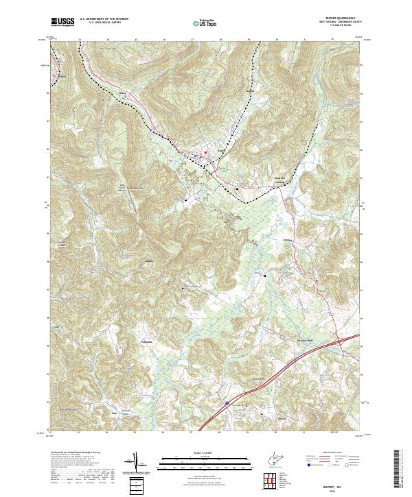
2023 Map of Rupert
USGS Topo · Published 2023About this map
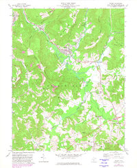
Rupert and Meadow Bluff sit within a landscape shaped by the Meadow River and its numerous tributaries in this western Greenbrier County region. The terrain is characterized by prominent ridges such as Mill Creek Mtn, Little Sewell Mountain, and Big Clear Creek Mountain, which hem in the narrow valleys where local communities have established themselves. Transport routes follow these natural corridors, with the Midland Trl W serving as a primary artery connecting settlements like Hines, McRoss, and Crawley.
Find a feature on this map
100 named features on this map. Tap any name to fly to it.
Don’t see what you’re looking for? This feature index may not catch every label — zoom into the map to look around manually.
Map Details
Editions of this 2023 Rupert Map
This is the sole edition of this map. No revisions or reprints were ever made.