
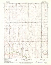
1966 Map of Rush Center
USGS Topo · Published 1967About this map
Rush Center serves as the focal point of this mid-1960s Kansas survey, situated where the Atchison Topeka and Santa Fe railroad tracks cross the agricultural landscape. The township is characterized by the meandering path of Walnut Creek, which cuts a verdant corridor through the surrounding plains. To the north, the Rush Center Oil Field indicates the local extraction industry, marked by a scattering of drilling sites and several Sandpits.
Find a feature on this map
18 named features on this map. Tap any name to fly to it.
Don’t see what you’re looking for? This feature index may not catch every label — zoom into the map to look around manually.
Map Details
Editions of this 1966 Rush Center Map
This is the sole edition of this map. No revisions or reprints were ever made.
Other maps of this area

1889 · Larned
USGS Topo · 1:125,000

1891 · Larned
USGS Topo · 1:125,000

1896 · Hays
USGS Topo · 1:125,000

1955 · Great Bend
USGS Topo · 1:250,000

1957 · Great Bend
USGS Topo · 1:250,000

1958 · Great Bend
USGS Topo · 1:250,000

1966 · Nekoma
USGS Topo · 1:24,000

1966 · La Crosse
USGS Topo · 1:24,000

1966 · Hargrave
USGS Topo · 1:24,000
1966 · Bison
USGS Topo · 1:24,000