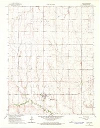
1966 Map of Bison
USGS Topo · Published 1967About this map
Bison stands as the central hub of this Rush County landscape, where the grain-hauling infrastructure of the Missouri Pacific railroad intersects with the agricultural plains. The 1966 survey reveals a community deeply rooted in its local institutions, evidenced by the clustered Baptist Cem and the Seventh Day Adventist Cem located along the rail line. Beyond the town limits, the geography is defined by a series of north-south drainages including Shelter Creek and Duck Creek, which flow toward the more prominent Sand Creek in the south.
Find a feature on this map
16 named features on this map. Tap any name to fly to it.
Don’t see what you’re looking for? This feature index may not catch every label — zoom into the map to look around manually.
Map Details
Editions of this 1966 Bison Map
This is the sole edition of this map. No revisions or reprints were ever made.
Other maps of this area

1889 · Larned
USGS Topo · 1:125,000

1891 · Larned
USGS Topo · 1:125,000

1896 · Hays
USGS Topo · 1:125,000

1955 · Great Bend
USGS Topo · 1:250,000

1957 · Great Bend
USGS Topo · 1:250,000

1958 · Great Bend
USGS Topo · 1:250,000
1965 · Otis
USGS Topo · 1:24,000
1965 · Albert
USGS Topo · 1:24,000

1966 · Rush Center
USGS Topo · 1:24,000

1966 · La Crosse
USGS Topo · 1:24,000