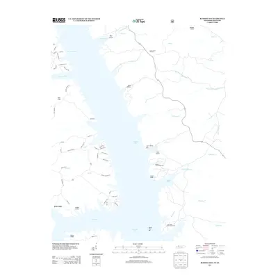
2013 Map of Rushing Bay
USGS Topo · Published 2013About this map
Kentucky Lake dominates this landscape where the Blood River and numerous creeks flow into the vast reservoir. Near the settlement of Boatwright, the terrain is defined by a series of prominent ridges and hollows, such as Kirk Ridge and Hooper Hollow, which reflect the complex shoreline of the Land Between the Lakes area. The map illustrates a contemporary recreational and residential landscape, featuring sites like the Rushing Creek Campground and Ginger Ridge Back Country Camp alongside a network of local roads.
Find a feature on this map
67 named features on this map. Tap any name to fly to it.
Don’t see what you’re looking for? This feature index may not catch every label — zoom into the map to look around manually.
Map Details
Editions of this 2013 Rushing Bay Map
This is the sole edition of this map. No revisions or reprints were ever made.
Other maps of this area

1936 · Tharpe
USGS Topo · 1:24,000

1936 · New Concord
USGS Topo · 1:24,000

1936 · Hamlin
USGS Topo · 1:24,000

1936 · Fenton
USGS Topo · 1:24,000

1936 · Hiatt
USGS Topo · 1:24,000

1936 · Golden Pond
USGS Topo · 1:48,000

1936 · Rushing
USGS Topo · 1:24,000

1936 · Hico
USGS Topo · 1:24,000
1940 · Hiatt
USGS Topo · 1:24,000

1942 · New Concord
USGS Topo · 1:24,000