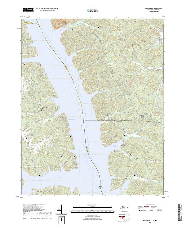
2022 Map of Rushing Bay
USGS Topo · Published 2022About this map
Kentucky Lake and the Tennessee River dominate this modern topographic landscape at the border of Tennessee and Kentucky. The area is defined by a dense network of cemeteries and family-named hollows that speak to generations of habitation along the riverbanks, including the Williams Cemetery, Hooper Cemetery, and Mays Cemetery. The terrain is characterized by the Tennessee Valley Divide and significant shoreline features like Cedar Bluff and Rushing Bay. Land use is evidenced by a complex system of named trails such as the Wild Bill Hickock Trail and Annie Oakley Trail, which weave through the heavily wooded ridges. The small settlement of Boatwright sits near the western shore, while the eastern side of the water is marked by numerous drainages like Jones Creek and the various forks of Rushing Creek.
Find a feature on this map
76 named features on this map. Tap any name to fly to it.
Don’t see what you’re looking for? This feature index may not catch every label — zoom into the map to look around manually.
Map Details
Editions of this 2022 Rushing Bay Map
This is the sole edition of this map. No revisions or reprints were ever made.
Other maps of this area

1936 · Tharpe
USGS Topo · 1:24,000

1936 · New Concord
USGS Topo · 1:24,000

1936 · Hamlin
USGS Topo · 1:24,000

1936 · Fenton
USGS Topo · 1:24,000

1936 · Hiatt
USGS Topo · 1:24,000

1936 · Golden Pond
USGS Topo · 1:48,000

1936 · Rushing
USGS Topo · 1:24,000

1936 · Hico
USGS Topo · 1:24,000
1940 · Hiatt
USGS Topo · 1:24,000

1942 · New Concord
USGS Topo · 1:24,000