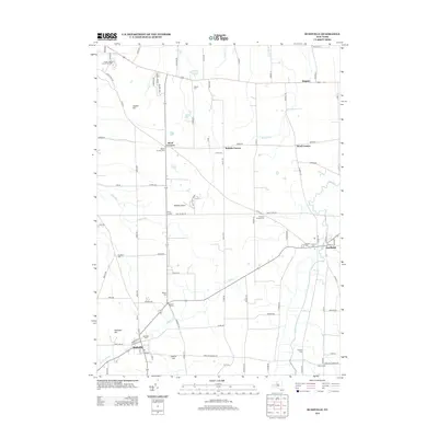
2013 Map of Rushville
USGS Topo · Published 2013About this map
Rushville and Gorham anchor the agricultural landscape of this Ontario County region, where the West River and Flint Cr define the local drainage patterns. The map reveals a dense network of burial grounds essential for genealogical research, including the Pioneer Cem and Reed's Corners Cem. The distribution of small hubs like Babbitt Corner, Wilson Corners, and Baldwin Corners suggests an enduring rural settlement pattern that persists alongside modern institutions such as the Finger Lakes Community Coll. Prominent terrain features such as Lazarus Hill and Harkness Hill rise above the surrounding fields, while transportation infrastructure is represented by Midlakes Airport and a grid of well-established county roads.
Find a feature on this map
87 named features on this map. Tap any name to fly to it.
Don’t see what you’re looking for? This feature index may not catch every label — zoom into the map to look around manually.
Map Details
Editions of this 2013 Rushville Map
This is the sole edition of this map. No revisions or reprints were ever made.
Other maps of this area

1900 · Naples
USGS Topo · 1:62,500

1900 · Canandaigua
USGS Topo · 1:62,500

1902 · Phelps
USGS Topo · 1:62,500

1903 · Naples
USGS Topo · 1:62,500

1903 · Canandaigua
USGS Topo · 1:62,500

1903 · Penn Yan
USGS Topo · 1:62,500

1913 · Naples
USGS Topo · 1:62,500

1942 · Penn Yan
USGS Topo · 1:31,680

1942 · Middlesex
USGS Topo · 1:31,680

1942 · Canandaigua
USGS Topo · 1:31,680