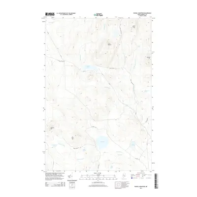
2014 Map of Russell Mountain
USGS Topo · Published 2014About this map
Russell Mountain and the surrounding high peaks of Somerset County dominate this remote North Woods landscape. This 2014 survey documents a region defined by commercial timber management and glacial hydrology, where relief is provided by summits like Little Russell Mtn and Mucalsea Mtn. The drainage network is complex, with Russell Stream and Little Russell Stream carving paths between the ridges, while numerous water bodies such as Russell Pond, Elm Pond, and the curiously named Lard Pond occupy the lowlands. Human activity is largely confined to a network of logging roads including Russell Pond Rd and Elm Pond Rd. This map captures the modern footprint of the Maine woods, showing the access routes used by sportsmen and foresters to reach the interior ponds and high ground of Nulhedus Mtn.
Find a feature on this map
31 named features on this map. Tap any name to fly to it.
Don’t see what you’re looking for? This feature index may not catch every label — zoom into the map to look around manually.
Map Details
Editions of this 2014 Russell Mountain Map
This is the sole edition of this map. No revisions or reprints were ever made.
Other maps of this area

1954 · Seboomook Lake
USGS Topo · 1:62,500

1954 · North East Carry
USGS Topo · 1:62,500

1954 · Caucomgomoc Lake
USGS Topo · 1:62,500

1954 · St. John Pond
USGS Topo · 1:62,500

1954 · Presque Isle
USGS Topo · 1:250,000

1954 · Millinocket
USGS Topo · 1:250,000

1958 · Presque Isle
USGS Topo · 1:250,000

1958 · Millinocket
USGS Topo · 1:250,000

1958 · Caucomgomoc Lake
USGS Topo · 1:62,500

1958 · Saint John Pond
USGS Topo · 1:62,500