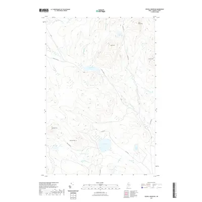
2021 Map of Russell Mountain
USGS Topo · Published 2021About this map
Russell Mtn dominates the high ground of Saint John Township in this modern survey of the North Woods, anchoring a landscape of heavy timber and intricate waterways. This region, documented in the early twenty-first century, is defined by its network of forest access routes like Russell Pond Rd and Elm Pond Rd which penetrate the dense terrain. The hydrology is centered on Russell Pond and the sprawling Russell Bog, with drainage flowing through Russell Stream and Nuthedus Stream. The presence of several distinct peaks, including Nuthedus Mtn and Mucalsea Mtn, suggests a topography that has long dictated the placement of logging roads and seasonal camps. To the south, Elm Pond and its namesake Elm Pond Mtn mark a secondary cluster of named features, illustrating the continuity of local nomenclature in this remote part of Somerset County.
Find a feature on this map
32 named features on this map. Tap any name to fly to it.
Don’t see what you’re looking for? This feature index may not catch every label — zoom into the map to look around manually.
Map Details
Editions of this 2021 Russell Mountain Map
This is the sole edition of this map. No revisions or reprints were ever made.
Other maps of this area

1954 · Seboomook Lake
USGS Topo · 1:62,500

1954 · North East Carry
USGS Topo · 1:62,500

1954 · Caucomgomoc Lake
USGS Topo · 1:62,500

1954 · St. John Pond
USGS Topo · 1:62,500

1954 · Presque Isle
USGS Topo · 1:250,000

1954 · Millinocket
USGS Topo · 1:250,000

1958 · Presque Isle
USGS Topo · 1:250,000

1958 · Millinocket
USGS Topo · 1:250,000

1958 · Caucomgomoc Lake
USGS Topo · 1:62,500

1958 · Saint John Pond
USGS Topo · 1:62,500