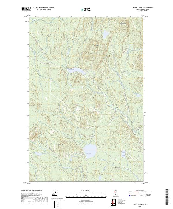
2024 Map of Russell Mountain
USGS Topo · Published 2024About this map
Russell Mtn and Little Russell Mtn anchor this upland region of Somerset County, where a network of logging roads and watercourses defines the landscape. The drainage patterns are intricate, with Russell Stream and Elm Stream collecting water from various high-elevation bogs and ponds. Significant peaks like Nulhedus Mtn and Mucalsea Mtn surround central water bodies, including the large Elm Pond and the more secluded Russell Pond. The road system, dominated by named routes such as the N Branch Access Rd and Russell Pond Rd, suggests an active timber or recreational land use. This area is characterized by its numerous small ponds like Bobs Pond and Bradley Pond, which are interconnected by seasonal brooks and streams, illustrating the hydrological complexity of the Maine interior.
Find a feature on this map
30 named features on this map. Tap any name to fly to it.
Don’t see what you’re looking for? This feature index may not catch every label — zoom into the map to look around manually.
Map Details
Editions of this 2024 Russell Mountain Map
This is the sole edition of this map. No revisions or reprints were ever made.
Other maps of this area

1954 · Seboomook Lake
USGS Topo · 1:62,500

1954 · North East Carry
USGS Topo · 1:62,500

1954 · Caucomgomoc Lake
USGS Topo · 1:62,500

1954 · St. John Pond
USGS Topo · 1:62,500

1954 · Presque Isle
USGS Topo · 1:250,000

1954 · Millinocket
USGS Topo · 1:250,000

1958 · Presque Isle
USGS Topo · 1:250,000

1958 · Millinocket
USGS Topo · 1:250,000

1958 · Caucomgomoc Lake
USGS Topo · 1:62,500

1958 · Saint John Pond
USGS Topo · 1:62,500
Featured Places
- Saint John Township, ME
- T5 R17 WELS, ME
- Russell Pond Township, ME
- Elm Stream Township, ME
- T4 R17 WELS, ME