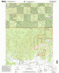
2001 Map of Russell Peak
USGS Topo · Published 2004About this map
Klamath National Forest dominates this northern California landscape, where the rugged topography of Russell Peak and McKinley Mountain descends into the agricultural reaches of Scott Valley. Along the southern edge of the sheet, the Scott River and East Fork Scott River converge, supporting local landmarks like the Meamber Bridge and Meamber School. The drainage network is complex, characterized by numerous gulches such as Graveyard Gulch, Joyland Gulch, and Franklin Gulch, many of which were centers of early 20th-century extraction. Evidence of the region's mining heritage is preserved in the locations of the Sheba Mine, Franklin Mine, and Gumboot Mine. Higher elevations reveal a history of seasonal ranching and pioneer habitation at Milk Ranch Meadows and the Baker Cabin near Baker Flat. This survey captures the intersection of industrial mining, high-country timber, and the valley floor's rural infrastructure, from Patterson Road to the riverside Grain Bins.
Find a feature on this map
45 named features on this map. Tap any name to fly to it.
Don’t see what you’re looking for? This feature index may not catch every label — zoom into the map to look around manually.
Map Details
Editions of this 2001 Russell Peak Map
This is the sole edition of this map. No revisions or reprints were ever made.
Other maps of this area

1886 · Shasta
USGS Topo · 1:250,000

1894 · Shasta
USGS Topo · 1:250,000

1914 · Seiad
USGS Topo · 1:125,000

1922 · Seiad
USGS Topo · 1:125,000

1932 · Yreka
USGS Topo · 1:96,000

1939 · Yreka
USGS Topo · 1:125,000

1948 · Weed
USGS Topo · 1:250,000

1950 · Weed
USGS Topo · 1:250,000

1955 · Seiad Valley
USGS Topo · 1:62,500

1955 · Condrey Mtn
USGS Topo · 1:62,500