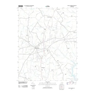
2010 Map of Russell Springs
USGS Topo · Published 2010About this map
Russell Springs serves as the central hub of this South Central Kentucky landscape, where the modern corridor of the Cumberland Pkwy intersects with long-established local routes. The map documents a transition from the rolling ridge-and-hollow terrain in the north, marked by settlements like Webbs Cross Roads and Sano, down toward the southern waters of Lake Cumberland. This area is defined by a series of prominent high points, including Clear Spring Ridge and McClendon Ridge, which separate the many branches of the local watershed such as Greasy Creek and Big Lily Creek. Genealogists and local historians can locate several family and community landmarks, including Phelps Cemetery, Lucenda Cemetery, and Hillcrest Cemetery, alongside infrastructure like the Russell County Airport near Middletown. The settlement pattern follows these ridges and stream valleys, illustrating how topography influenced the development of small communities like Esto and Humble.
Find a feature on this map
83 named features on this map. Tap any name to fly to it.
Don’t see what you’re looking for? This feature index may not catch every label — zoom into the map to look around manually.
Map Details
Editions of this 2010 Russell Springs Map
This is the sole edition of this map. No revisions or reprints were ever made.
Other maps of this area

1911 · Monticello
USGS Topo · 1:62,500

1914 · Monticello
USGS Topo · 1:62,500

1953 · Phil
USGS Topo · 1:24,000

1953 · Montpelier
USGS Topo · 1:24,000

1953 · Creelsboro
USGS Topo · 1:24,000

1953 · Jamestown
USGS Topo · 1:24,000

1953 · Dunnville
USGS Topo · 1:24,000

1954 · Jabez
USGS Topo · 1:24,000

1954 · Knifley
USGS Topo · 1:24,000

1954 · Russell Springs
USGS Topo · 1:24,000