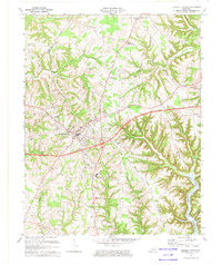
1973 Map of Russell Springs
USGS Topo · Published 1974About this map
Russell Springs serves as the focal point of this 1970s survey, illustrating a community evolving alongside the Cumberland Parkway. The landscape is a complex network of ridges, including the prominent Half Acre Ridge and Foley Ridge, which funnel water toward the deep inlets of Cumberland Lake in the southeast. This era captures the town's expansion toward Middletown and Esto, evidenced by the presence of the County High Sch, the County Airport, and a local Drive-in Theater. Rural life remains anchored by a dense distribution of small community hubs like Sano, Jericho, and Webbs Cross Roads. Numerous country churches and cemeteries, such as New Friendship Ch and Sulphur Cem, are scattered throughout the hills, providing essential touchpoints for genealogists tracing family ties in the Adair and Russell county borderlands.
Find a feature on this map
63 named features on this map. Tap any name to fly to it.
Don’t see what you’re looking for? This feature index may not catch every label — zoom into the map to look around manually.
Map Details
Editions of this 1973 Russell Springs Map
This is the sole edition of this map. No revisions or reprints were ever made.
Other maps of this area

1911 · Monticello
USGS Topo · 1:62,500

1914 · Monticello
USGS Topo · 1:62,500

1953 · Phil
USGS Topo · 1:24,000

1953 · Montpelier
USGS Topo · 1:24,000

1953 · Creelsboro
USGS Topo · 1:24,000

1953 · Jamestown
USGS Topo · 1:24,000

1953 · Dunnville
USGS Topo · 1:24,000

1954 · Jabez
USGS Topo · 1:24,000

1954 · Knifley
USGS Topo · 1:24,000

1954 · Russell Springs
USGS Topo · 1:24,000