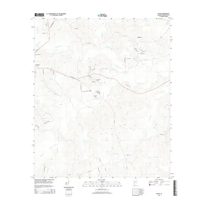
2014 Map of Rutan
USGS Topo · Published 2014About this map
Chatom serves as the primary western anchor for this topographic study of Washington County, where the landscape transitions into the rolling creek bottoms of the Bassetts Cr drainage system. The map documents a predominantly rural infrastructure characterized by small family and community burial grounds, including Pine Level Cem near Hobson and both Rutan Cem and Richardson Cem further south. The Roy Wilcox Airport provides a modern navigational landmark amidst a network of established local routes like St Stephens Ave and Abb Rd. A complex hydrological network defines the terrain, with names such as Little Bassetts Cr, Dearman Branch, and Armstrong Cr suggesting the varied elevations and watercourses that have long dictated the placement of settlements and transport corridors in this part of Alabama.
Find a feature on this map
58 named features on this map. Tap any name to fly to it.
Don’t see what you’re looking for? This feature index may not catch every label — zoom into the map to look around manually.
Map Details
Editions of this 2014 Rutan Map
This is the sole edition of this map. No revisions or reprints were ever made.
Other maps of this area

1943 · McIntosh
USGS Topo · 1:62,500

1944 · McIntosh
USGS Topo · 1:62,500

1953 · Hattiesburg
USGS Topo · 1:250,000

1958 · Hattiesburg
USGS Topo · 1:250,000

1971 · Bigbee
USGS Topo · 1:24,000

1972 · St. Stephens
USGS Topo · 1:24,000

1974 · Millry South
USGS Topo · 1:24,000

1974 · Chatom
USGS Topo · 1:24,000

1974 · Vinegar Bend
USGS Topo · 1:24,000
1982 · Wagarville
USGS Topo · 1:24,000