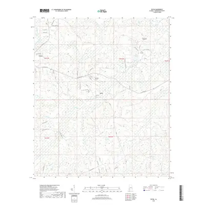
2018 Map of Rutan
USGS Topo · Published 2018About this map
Chatom and the small settlements of Hobson and Rutan anchor this survey of Washington County, Alabama. The landscape is defined by an intricate network of waterways, including Bassetts Cr, Little Bassetts Cr, and the marshy expanses of Calf Pasture Swamp and Bull Hall Swamp. This area maintains a strong connection to its local history through several documented burial sites like Pine Level Cem, Rutan Cem, and Richardson Cem. The presence of the Roy Wilcox Airport near the center of the quadrangle indicates the area's modern infrastructure, while the myriad named branches and creeks such as Dearman Branch and Armstrong Creek suggest a terrain heavily influenced by its drainage patterns into the local river systems.
Find a feature on this map
69 named features on this map. Tap any name to fly to it.
Don’t see what you’re looking for? This feature index may not catch every label — zoom into the map to look around manually.
Map Details
Editions of this 2018 Rutan Map
This is the sole edition of this map. No revisions or reprints were ever made.
Other maps of this area

1943 · McIntosh
USGS Topo · 1:62,500

1944 · McIntosh
USGS Topo · 1:62,500

1953 · Hattiesburg
USGS Topo · 1:250,000

1958 · Hattiesburg
USGS Topo · 1:250,000

1971 · Bigbee
USGS Topo · 1:24,000

1972 · St. Stephens
USGS Topo · 1:24,000

1974 · Millry South
USGS Topo · 1:24,000

1974 · Chatom
USGS Topo · 1:24,000

1974 · Vinegar Bend
USGS Topo · 1:24,000
1982 · Wagarville
USGS Topo · 1:24,000