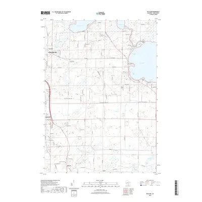
2018 Map of Rutland
USGS Topo · Published 2018About this map
Lake Kegonsa and Lake Waubesa anchor the north, framing a landscape defined by the glaciated topography of south-central Wisconsin. The villages of Oregon and Fitchburg show their modern footprints, while the smaller hamlets of Rutland and Stone preserve their historical positions in the southern agricultural lands. The terrain is marked by numerous marshy depressions and smaller water bodies such as Grass Lake and Mud Lake, which drain through the systems of Badfish Creek and Oregon Br.
Find a feature on this map
96 named features on this map. Tap any name to fly to it.
Don’t see what you’re looking for? This feature index may not catch every label — zoom into the map to look around manually.
Map Details
Editions of this 2018 Rutland Map
This is the sole edition of this map. No revisions or reprints were ever made.
Other maps of this area

1889 · Evansville
USGS Topo · 1:62,500

1890 · Madison
USGS Topo · 1:62,500

1890 · Sun Prairie
USGS Topo · 1:62,500

1890 · Stoughton
USGS Topo · 1:62,500

1892 · Madison
USGS Topo · 1:62,500

1894 · Evansville
USGS Topo · 1:62,500

1896 · Sun Prairie
USGS Topo · 1:62,500

1904 · Madison
USGS Topo · 1:62,500

1905 · Sun Prairie
USGS Topo · 1:62,500

1906 · Evansville
USGS Topo · 1:62,500