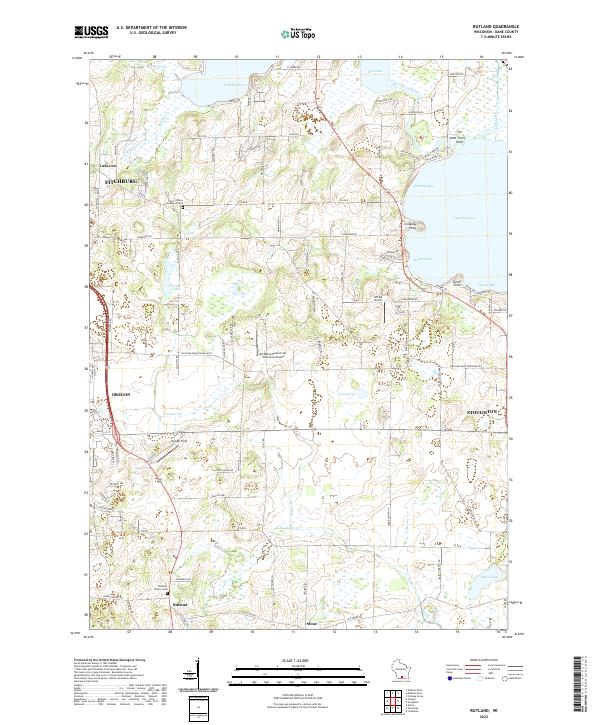
2022 Map of Rutland
USGS Topo · Published 2022About this map
The Yahara River system defines the northern half of this landscape, connecting the expansive waters of Lake Waubesa and Lake Kegonsa. These glacial lakes are surrounded by a network of smaller wetlands and basins, including Grass Lake, Mud Lake, and Island Lake, which have historically influenced the settlement patterns and road networks of Dane County. The map details the outskirts of growing communities like Oregon, Fitchburg, and Stoughton, while preserving the location of older rural sites like the Town of Dunn Burying Ground.
Find a feature on this map
103 named features on this map. Tap any name to fly to it.
Don’t see what you’re looking for? This feature index may not catch every label — zoom into the map to look around manually.
Map Details
Editions of this 2022 Rutland Map
This is the sole edition of this map. No revisions or reprints were ever made.
Other maps of this area

1889 · Evansville
USGS Topo · 1:62,500

1890 · Madison
USGS Topo · 1:62,500

1890 · Sun Prairie
USGS Topo · 1:62,500

1890 · Stoughton
USGS Topo · 1:62,500

1892 · Madison
USGS Topo · 1:62,500

1894 · Evansville
USGS Topo · 1:62,500

1896 · Sun Prairie
USGS Topo · 1:62,500

1904 · Madison
USGS Topo · 1:62,500

1905 · Sun Prairie
USGS Topo · 1:62,500

1906 · Evansville
USGS Topo · 1:62,500