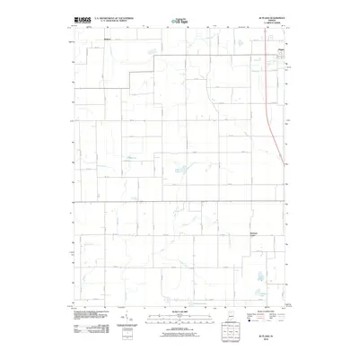
2010 Map of Rutland
USGS Topo · Published 2010About this map
Rutland and the western edge of Argos anchor this northern Indiana landscape, where a sophisticated network of agricultural drainage defines the terrain. The area is marked by numerous man-made waterways such as Clifton Ditch, Warner Ditch, and Leffert Ditch, which redirect water away from the surrounding fields and toward natural features like Wolf Creek and Eddy Creek. These ditches represent a long-standing engineering effort to manage the high water table common in Marshall County. Small glacial remnants persist in the form of isolated water bodies, including Mud Lake, Eddy Lake, and Zink Lake. To the south, the settlement of Richland Center sits at the intersection of a grid-based road system, which reflects the organized land division of the region. This 2010 survey provides a clear view of the balance between small-town residential growth and the essential infrastructure required for modern Indiana farming.
Find a feature on this map
69 named features on this map. Tap any name to fly to it.
Don’t see what you’re looking for? This feature index may not catch every label — zoom into the map to look around manually.
Map Details
Editions of this 2010 Rutland Map
This is the sole edition of this map. No revisions or reprints were ever made.
Other maps of this area

1953 · Chicago
USGS Topo · 1:250,000

1957 · Chicago
USGS Topo · 1:250,000

1957 · Inwood
USGS Topo · 1:24,000

1957 · Plymouth
USGS Topo · 1:24,000

1958 · Donaldson
USGS Topo · 1:24,000

1962 · Pershing
USGS Topo · 1:24,000

1962 · Kewanna
USGS Topo · 1:24,000

1962 · Argos
USGS Topo · 1:24,000
1962 · Rochester
USGS Topo · 1:24,000

1962 · Culver
USGS Topo · 1:24,000