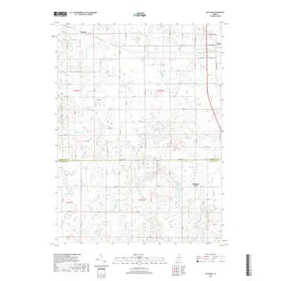
2019 Map of Rutland
USGS Topo · Published 2019About this map
Rutland sits at the northern edge of this survey, anchoring a rural landscape defined by an extensive drainage network that spans the Marshall and Fulton County line. The settlement of Argos is visible in the northeastern corner, where Indiana Ave and Marshall St define the local grid. This area is characterized by a high concentration of named water management features, such as Leffert Ditch, Myers Ditch, and Clifton Ditch, reflecting a long history of land reclamation for agriculture.
Find a feature on this map
80 named features on this map. Tap any name to fly to it.
Don’t see what you’re looking for? This feature index may not catch every label — zoom into the map to look around manually.
Map Details
Editions of this 2019 Rutland Map
This is the sole edition of this map. No revisions or reprints were ever made.
Other maps of this area

1953 · Chicago
USGS Topo · 1:250,000

1957 · Chicago
USGS Topo · 1:250,000

1957 · Inwood
USGS Topo · 1:24,000

1957 · Plymouth
USGS Topo · 1:24,000

1958 · Donaldson
USGS Topo · 1:24,000

1962 · Pershing
USGS Topo · 1:24,000

1962 · Kewanna
USGS Topo · 1:24,000

1962 · Argos
USGS Topo · 1:24,000
1962 · Rochester
USGS Topo · 1:24,000

1962 · Culver
USGS Topo · 1:24,000