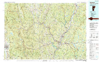
1985 Map of Rutland
USGS Topo · Published 1988About this map
The Connecticut River serves as the central spine of this mid-1980s regional survey, marking the border between Vermont and New Hampshire. This era shows the developed transportation corridor concentrated at the confluence of the White River and the Connecticut, where White River Junction stands as a significant rail and road hub. The map captures the industrial and logistical character of the Upper Valley, with the Central Vermont RR, Boston & Maine RR, and Vermont Railway lines threading through the river valleys.
Find a feature on this map
296 named features on this map. Tap any name to fly to it.
Don’t see what you’re looking for? This feature index may not catch every label — zoom into the map to look around manually.
Map Details
Editions of this 1985 Rutland Map
This is the sole edition of this map. No revisions or reprints were ever made.
Other maps of this area

1891 · Rutland
USGS Topo · 1:62,500

1893 · Wallingford
USGS Topo · 1:62,500

1893 · Rutland
USGS Topo · 1:62,500

1894 · Pawlet
USGS Topo · 1:62,500

1895 · Castleton
USGS Topo · 1:62,500

1896 · Strafford
USGS Topo · 1:62,500

1897 · Pawlet
USGS Topo · 1:62,500

1897 · Castleton
USGS Topo · 1:62,500

1902 · Sunapee
USGS Topo · 1:62,500

1902 · Brandon
USGS Topo · 1:62,500