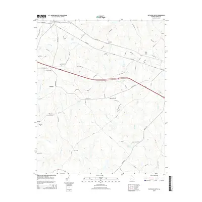
2014 Map of Rutledge South
USGS Topo · Published 2014About this map
Rutledge and the surrounding Morgan County countryside appear here as a landscape of established crossroads and family landmarks in the early twenty-first century. The area is defined by its watercourses, including Hard Labor Creek to the north and the southern flow of the Little River. Historic community centers are often marked by their spiritual anchors, such as the Macedonia Baptist Church Cem and Mars Hill Church Cem, which serve as vital touchstones for local genealogy.
Find a feature on this map
86 named features on this map. Tap any name to fly to it.
Don’t see what you’re looking for? This feature index may not catch every label — zoom into the map to look around manually.
Map Details
Editions of this 2014 Rutledge South Map
This is the sole edition of this map. No revisions or reprints were ever made.
Other maps of this area

1896 · Monroe
USGS Topo · 1:125,000

1953 · Athens
USGS Topo · 1:250,000

1958 · Athens
USGS Topo · 1:250,000

1959 · Athens
USGS Topo · 1:250,000

1963 · Athens
USGS Topo · 1:250,000

1971 · Rutledge North
USGS Topo · 1:24,000
1971 · Social Circle
USGS Topo · 1:24,000

1972 · Shady Dale
USGS Topo · 1:24,000

1972 · Apalachee
USGS Topo · 1:24,000

1972 · Rock Eagle Lake
USGS Topo · 1:24,000