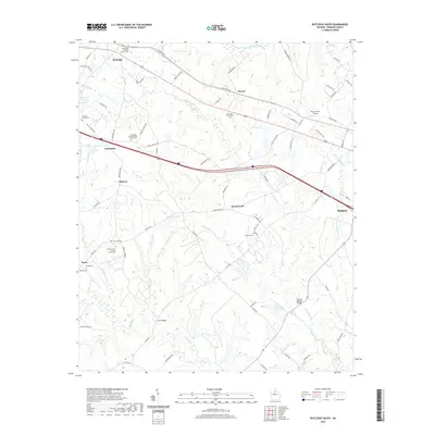
2020 Map of Rutledge South
USGS Topo · Published 2020About this map
Hard Labor Creek flows across the northern edge of this landscape, anchoring a rural Georgia region defined by its dispersed settlements and numerous country cemeteries. The map centers on the small communities of Dorsey, Centennial, and Dickson, where the local heritage is deeply tied to spiritual centers such as the Macedonia Baptist Church Cem and the Mars Hill Church Cem. These church grounds, along with family-associated sites like Cheney - Towns Cem, provide a detailed record of the area's genealogical history.
Find a feature on this map
85 named features on this map. Tap any name to fly to it.
Don’t see what you’re looking for? This feature index may not catch every label — zoom into the map to look around manually.
Map Details
Editions of this 2020 Rutledge South Map
This is the sole edition of this map. No revisions or reprints were ever made.
Other maps of this area

1896 · Monroe
USGS Topo · 1:125,000

1953 · Athens
USGS Topo · 1:250,000

1958 · Athens
USGS Topo · 1:250,000

1959 · Athens
USGS Topo · 1:250,000

1963 · Athens
USGS Topo · 1:250,000

1971 · Rutledge North
USGS Topo · 1:24,000
1971 · Social Circle
USGS Topo · 1:24,000

1972 · Shady Dale
USGS Topo · 1:24,000

1972 · Apalachee
USGS Topo · 1:24,000

1972 · Rock Eagle Lake
USGS Topo · 1:24,000