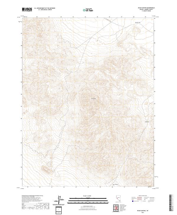
2021 Map of Ryan Canyon
USGS Topo · Published 2021About this map
Gillis Range dominates this portion of Mineral County, where steep topographic contours reveal a landscape defined by significant elevation changes and high desert passes. The terrain is bisected by Ryan Pass and the namesake Ryan Canyon, suggesting historical routes through these mountains. Human activity in this arid environment is sparsely documented, primarily represented by the presence of Wildhorse Cyn Rd cutting across the northern reaches of the quadrangle. High plateaus like Buckley Flat sit at the edges of the range, providing a stark contrast to the deeply etched drainage patterns found throughout the central mountains. This 2021 survey utilizes high-resolution data to map the complex land systems and township boundaries that divide this remote section of Nevada.
Find a feature on this map
9 named features on this map. Tap any name to fly to it.
Don’t see what you’re looking for? This feature index may not catch every label — zoom into the map to look around manually.
Map Details
Editions of this 2021 Ryan Canyon Map
This is the sole edition of this map. No revisions or reprints were ever made.
Other maps of this area

1909 · Hawthorne
USGS Topo · 1:250,000

1911 · Hawthorne
USGS Topo · 1:250,000

1915 · Hawthorne
USGS Topo · 1:250,000

1948 · Walker Lake
USGS Topo · 1:250,000

1955 · Hawthorne
USGS Topo · 1:62,500

1957 · Walker Lake
USGS Topo · 1:250,000

1962 · Walker Lake
USGS Topo · 1:250,000

1964 · Walker Lake
USGS Topo · 1:250,000

1964 · Gillis Canyon
USGS Topo · 1:62,500
1979 · Copper Mtn.
USGS Topo · 1:24,000