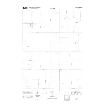
2013 Map of Ryan
USGS Topo · Published 2013About this map
The settlement of Ryan serves as the primary hub for this Delaware County landscape, where the local street grid including Union St and Howard St transitions into a vast network of section-line roads. This agricultural territory is defined by its intricate drainage patterns, with numerous waterways like Nugents Cr and Buck Cr carving through the prairie. The map documents the rural community of Hazel Green (also noted as Hazle Green) in the northeast, illustrating the persistent importance of small crossroads settlements in the regional geography. The presence of Linn Delaware Rd and Monticello Rd underscores the connectivity between these farming townships and neighboring trade centers. Researchers will find a highly organized rural infrastructure, from the family-named Hills Mill Rd to the various branches and creeks like Golden Br and Silver Cr that dictated the early placement of homesteads and thoroughfares.
Find a feature on this map
49 named features on this map. Tap any name to fly to it.
Don’t see what you’re looking for? This feature index may not catch every label — zoom into the map to look around manually.
Map Details
Editions of this 2013 Ryan Map
This is the sole edition of this map. No revisions or reprints were ever made.
Other maps of this area

1888 · Marion
USGS Topo · 1:62,500

1889 · Marion
USGS Topo · 1:62,500

1890 · Anamosa
USGS Topo · 1:62,500

1900 · Anamosa
USGS Topo · 1:125,000

1903 · Winthrop
USGS Topo · 1:125,000

1959 · Dubuque
USGS Topo · 1:250,000

1961 · Dubuque
USGS Topo · 1:250,000

1962 · Dubuque
USGS Topo · 1:250,000
1968 · Central City
USGS Topo · 1:24,000
1973 · Manchester
USGS Topo · 1:24,000