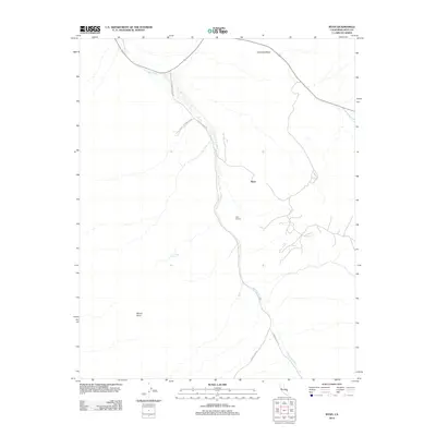
2012 Map of Ryan
USGS Topo · Published 2012About this map
Ryan and the nearby Ryan Widow stand as central points of interest in this arid corridor of Death Valley National Park. The landscape is dominated by the sprawling Furnace Cr Wash, a drainage feature that dictates the path of Furnace Creek Rd as it snakes through the terrain. This 2012 survey illustrates the sparse but critical water sources and topographic markers essential for navigating the region, including the curiously named Lemonade Spring tucked away between the peaks. Rising above the desert floor, Mount Perry and Travertine Point provide significant vertical relief and serve as natural landmarks for those traveling along Dantes View Rd. The mapping reflects a modern era of park management where access roads and natural washes are the primary infrastructure in an otherwise undeveloped expanse of Inyo County.
Find a feature on this map
9 named features on this map. Tap any name to fly to it.
Don’t see what you’re looking for? This feature index may not catch every label — zoom into the map to look around manually.
Map Details
Editions of this 2012 Ryan Map
This is the sole edition of this map. No revisions or reprints were ever made.
Other maps of this area

1908 · Furnace Creek
USGS Topo · 1:250,000

1910 · Furnace Creek
USGS Topo · 1:250,000

1948 · Death Valley
USGS Topo · 1:250,000

1951 · Funeral Peak
USGS Topo · 1:62,500

1952 · Furnace Creek
USGS Topo · 1:62,500

1952 · Ryan
USGS Topo · 1:62,500

1952 · Bennetts Well
USGS Topo · 1:62,500

1954 · Death Valley
USGS Topo · 1:250,000

1956 · Death Valley
USGS Topo · 1:250,000

1957 · Death Valley
USGS Topo · 1:250,000